From Exploring Fractals by Bernt Wahl (1995)
Neighborhoods in Relationship to Other Places
Similarly in Fractal mathematics, geometric figures such as the Mandelbrot Set are continuously divided into finer sections. The Mandelbrot Set exhibits structure that when examined at greater magnification seems to be forever changing, while still retaining a structure uniquely defined to its equation. This entire structure can be mapped using a basic coordinate system mapped out over the real and imaginary plane. Here complex numbers in their algebraic form of , where denotes the real part and the imaginary part. A standard way to represent this is on a graph, where the -axis represents the real parts and the -axis represents the imaginary parts. A coordinate system similar to the way longitude and latitude coordinates are demarcated on a map. When resolution is increased, terms are carried out to the precision needed. It is only when a recognizable cluster forms that an name identity is given to the new unit. 
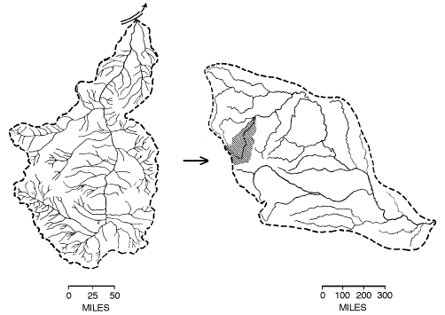
Today this methodology is manifested in other areas such as geographic mapping. Not only natural objects but also natural processes have fractal structure. A river, for instance, is created from smaller tributaries that flow together: brooks flow into creeks, which flow into streams, which flow into rivers. The same process takes place at different scales. Brooks flow into creeks at the smallest scale in the process, and streams flow into rivers at the largest scale. Thus, the process has a fractal structure, because it shows similar structures at different scales.
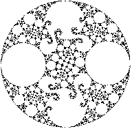
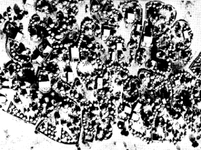
In Africa, you will find self-similar structure incorporated in community design. Figure 1.29 compares a Songhai village in Mali to a circular fractal. How would you account for the similarity. Some say that the fractal pattern was adopted because it makes efficient use of space. Others suggest that the village is an conscious expression of a fractal structure that became a cultural construct of many regions in Africa.

Figure 1.29 The Songhai settlement compared to circular fractals.
Courtesy of Duly4 © 1979 and Mandelbrot5 © 1982
http://www.wahl.org/fe/HTML_version/link/FE1W/c1.htm

