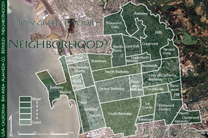
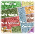
Neighborhood Boundary Data
Hand drawn polygons that follow street boundaries and other major distinguishing land traits such as railroads, rivers, highways, etc. Find out more about why it's important to use land traits as distinct dividing lines that form borders...
Covering the majority of the major US cities, Factle's neighborhood boundaries come in the form of the geo standard .SHP and .KML, but other formats are available upon request. With no overlapping polygon boundaries, the data is ideal for address search, clean web display, and more accurate data analysis.
Neighborhood Demographic Data
Factle also offers demographic data that matches with it's neighborhoods, with over 100 attributes the data allows companies and researchers alike to quantify the specifics in a neighborhood and compare them with neighborhoods side by side.
 Other Neighborhood Data Types
- Neighborhood Names
- Neighborhood Centroids
- Neighborhoods to Zipcodes
(Zipcodes to Neighborhoods)
Contact us for more information regarding our neighborhood data!