Factle mapping out the world one neighborhood at a time... the place where others come to get ideas.
Through rigorous research and meticulous mapping, Factle Maps strives to deliver the best in neighborhood boundary and demographic data. Answering the question of what exactly a neighborhood is and why it is so important, our desire is to provide our business and academic partners with the tools to reach the next level and make a greater impact.
Neighborhood Boundaries & Identifying Localized - Where 2.0
- U.S. City Neighborhood Names and Boundaries Database
- U.S. City Neighborhood Demographic Data(2008)
- U.S. Zipcode and Neighborhood Conversion Database
- International Cities Neighborhood Names and Boundaries Database
- Digital Map Production Capabilities for Nations Around the World
- Custom Geospatial Mapping Work and Consulting Services
- HyperLocal and SEO/SEM consulting services
Popular Products and Service


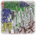
Neighborhood Boundary Mapping
A place built on identity, neighborhoods represent the social perception of a location, what we consider our community, and the interweaving of our routine social engagements. As one of the most homogeneous units one can find, it also provides a better means for location intelligence & understanding social interaction and it's effects.
The Power of Neighborhoods & the Applications
Today, neighborhood data is being used to improve SEO for Real Estate and Social Networking sites, provide better avenues for people to search for things, generate greater focus for direct marketing and localized news, study the spread of diseases, and solving other real world problems like crime and poverty.